
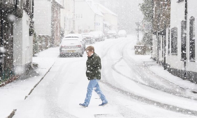
Sub-zero temperatures are likey to return to the UK – as long-range forcast maps from WXCharts shows a massive snow bank heading towards the country next month
A number of long-range forecast maps show the UK is likely to be battered by snow next month – with temperatures expected to plummet to as low as -10C.
The Met Office says snow could make a comeback ‘within weeks’ as parts of the country recover from the chaos and wreckage left by Storms Jocelyn and Isha.
While Britain has seen much milder temperatures in the last few days, weather maps from WXCharts show that colder spells are expected to make a return as early as February 6. Diagrams show a massive snow bank heading towards Britain, with snow blasts expected in southern Scotland, northern England and Yorkshire.
Another map showing a 572-mile “wall” of snow just days later on February 10 shows freezing conditions stretching from Manchester to Lerwick, Scotland. More flurries are expected to blanket Northern Ireland, while Scotland will also see a number of small, isolated snow showers in the next two weeks.
The Met Office is forecasting that conditions will stay warmer than average for the rest of January, before getting chilly again midway through February, creating the risk of snow.
The forecast comes just days after two “danger to life” alerts hit large swathes of the country. Gale-force winds and heavy rain brought on by Storms Jocelyn and Isha meant many Brits were faced with power cuts, travel disruptions and flooding.
The Met Office’s forecast from February 8 to February 22 suggests snow could now return to the UK. Weather maps show that as the country enters the mid-February period, temperatures could drop sub-zero again, and even plummet to as low as -10C in parts of Scotland.
The Met Office said: “Through the middle of February, changeable conditions are most likely with the wettest and windiest conditions in the north and northwest. It is likely to be drier further southeast, although some wet and windy spells are still possible here.
“Later in the month there is an increasing likelihood of winds from the north or east, which will increase the chance of some colder spells and perhaps snow.”
Until then, snow is not expected, but the UK’s national weather service has warned Brits to watch out for wind and rain.
Speaking to the Mirror, senior spokesman Stephen Dixon said the “unusually mild” temperatures felt in recent days – including highs of 14C on Thursday afternoon in the southeast – are set to be replaced next month due to the arrival of a new mass of Arctic air.
Mr Dixon added: “Signals point to the chance of a cold spell and snow in mid and late February in the North.”
There will also be no major storms expected this week after the UK was battered by the deadly Storm Isha and Storm Jocelyn. Mr Dixon added that these storms are usually precluded by amber wind alerts, and that none are forecast in the coming days.


